How hard is the coast on your house?
Every coastal suburb corrodes at a different rate. Find yours to see its corrosivity zone, how far it sits from open surf, and how often things actually need attention there.
Start typing to find your suburb.
AS 4312 corrosivity zones by suburb, Dawesville to Two Rocks
Grouped by region, south to north. Open a region to see its suburbs, or search above to jump straight to yours. Where a suburb spans two bands we show both rather than averaging them, because the average describes nobody's house.
49 suburbs
Peel / Mandurah C5/C4 to C3
| Suburb | Zone | Distance to surf | Location page |
|---|---|---|---|
| Dawesville Peel / Mandurah | C4/C3 | 200m – 2.5km Pyramids Beach side at the closest point | View → |
| Wannanup Peel / Mandurah | C5/C4 | 40m – 1.8km Avalon Beach frontage at the closest point | View → |
| Falcon Peel / Mandurah | C5/C4 | 30m – 1.2km Falcon Bay frontage at the closest point | View → |
| Bouvard Peel / Mandurah | C4/C3 | 300m – 4km Western coastal blocks at the closest point | View → |
| Halls Head Peel / Mandurah | C5/C4 | 0m Estuary to east | View → |
| Erskine Peel / Mandurah | C3 | 2.5km Direct frontage is to the Peel Inlet on the eastern boundary | View → |
| Mandurah Peel / Mandurah | C4 | Coastal frontage + large estuary system through the suburb | View → |
| Dudley Park Peel / Mandurah | C3 | 3km Direct frontage is to the Mandurah canals and estuary | View → |
| Silver Sands Peel / Mandurah | C5/C4 | 25m – 800m Mandurah Terrace at the closest point | View → |
| San Remo Peel / Mandurah | C5/C4 | 30m – 700m Watersun Beach frontage at the closest point | View → |
| Madora Bay Peel / Mandurah | C5/C4 | 25m – 1.3km Original beachfront subdivision at the closest point | View → |
Golden Bay - Rockingham C5/C4 to C4/C3
| Suburb | Zone | Distance to surf | Location page |
|---|---|---|---|
| Golden Bay Golden Bay - Rockingham | C4 | 40m – 1.2km Dampier Drive frontage at the closest point | View → |
| Singleton Golden Bay - Rockingham | C4 | 35m – 1.4km Singleton Beach frontage at the closest point | View → |
| Secret Harbour Golden Bay - Rockingham | C5/C4 | 0m Most homes within walking distance of the beach | View → |
| Port Kennedy Golden Bay - Rockingham | C4/C3 | 60m – 3km Becher Point frontage at the closest point | View → |
| Warnbro Golden Bay - Rockingham | C4/C3 | 80m – 2.5km Beachfront reserve at the closest point | View → |
| Waikiki Golden Bay - Rockingham | C4/C3 | 50m – 3.5km Foreshore strip at the closest point | View → |
| Safety Bay Golden Bay - Rockingham | C4 | 25m – 1.5km Safety Bay Road foreshore at the closest point | View → |
| Shoalwater Golden Bay - Rockingham | C4 | 20m – 700m Arcadia Drive foreshore at the closest point | View → |
| Rockingham Golden Bay - Rockingham | C4 | Beachfront at Mangles Bay (sheltered southern Cockburn Sound) | View → |
| Peron Golden Bay - Rockingham | C4 | 40m – 900m Point Peron Road frontage at the closest point | View → |
Cockburn C5 to C5/C4
| Suburb | Zone | Distance to surf | Location page |
|---|---|---|---|
| Coogee Cockburn | C5/C4 | 30m – 1km Coogee Beach Road at the closest point | View → |
| North Coogee Cockburn | C5 | 200m – 1.1km Beachfront/marina edge at the closest point | View → |
Fremantle / Melville C5/C4 to C4
| Suburb | Zone | Distance to surf | Location page |
|---|---|---|---|
| South Fremantle Fremantle / Melville | C5/C4 | 200m – 800m South Beach strip at the closest point | View → |
| Fremantle Fremantle / Melville | C4 | 0m 0 m: Indian Ocean to the west, Swan River mouth/harbour to the north | View → |
| North Fremantle Fremantle / Melville | C5/C4 | 200m – 900m Beachfront at the closest point | View → |
Western Suburbs C5/C4
| Suburb | Zone | Distance to surf | Location page |
|---|---|---|---|
| Mosman Park Western Suburbs | C5/C4 | 200m – 1.5km Beachfront strip at the closest point | View → |
| Cottesloe Western Suburbs | C5/C4 | 0m Grading east of the railway line | View → |
| Swanbourne Western Suburbs | C5/C4 | 200m – 900m Beachfront at the closest point | View → |
| City Beach Western Suburbs | C5/C4 | 0m Large oceanfront homes directly facing the surf | View → |
Stirling Coast C5 to C5/C4
| Suburb | Zone | Distance to surf | Location page |
|---|---|---|---|
| Scarborough Stirling Coast | C5/C4 | 0m Dense beachfront including apartment towers | View → |
| Trigg Stirling Coast | C5 | 200m – 700m Beachfront at the closest point | View → |
| North Beach Stirling Coast | C5/C4 | 20m – 1.2km West Coast Drive at the closest point | View → |
| Watermans Bay Stirling Coast | C5 | 15m – 900m West Coast Drive at the closest point | View → |
| Marmion Stirling Coast | C5 | 200m – 800m Marine Terrace beachfront at the closest point | View → |
| Sorrento Stirling Coast | C5/C4 | 30m – 1.6km West Coast Drive at the closest point | View → |
Joondalup Coast C5 to C4/C3
| Suburb | Zone | Distance to surf | Location page |
|---|---|---|---|
| Hillarys Joondalup Coast | C5/C4 | 0m Hillarys Boat Harbour marina infrastructure | View → |
| Kallaroo Joondalup Coast | C4/C3 | 250m – 2km Northshore, west of Dampier Avenue at the closest point | View → |
| Mullaloo Joondalup Coast | C5/C4 | 25m – 1.4km Oceanside Promenade at the closest point | View → |
| Ocean Reef Joondalup Coast | C5/C4 | 30m – 1.8km Coastal dune path at the closest point | View → |
| Iluka Joondalup Coast | C5 | 200m – 700m Beaumaris Beach edge at the closest point | View → |
| Burns Beach Joondalup Coast | C5 | 200m – 900m Burns Beach Rd beachfront at the closest point | View → |
Wanneroo Coast C5 to C4
| Suburb | Zone | Distance to surf | Location page |
|---|---|---|---|
| Mindarie Wanneroo Coast | C5 | 0m Built around the Mindarie Keys marina | View → |
| Quinns Rocks Wanneroo Coast | C5/C4 | 20m – 2km Ocean Drive at the closest point | View → |
| Jindalee Wanneroo Coast | C5 | 25m – 900m Eden Beach frontage at the closest point | View → |
| Alkimos Wanneroo Coast | C5 | 0m Large estates extending inland | View → |
| Eglinton Wanneroo Coast | C5/C4 | 80m – 2km Coastal stages at the closest point | View → |
| Yanchep Wanneroo Coast | C4 | 0m The northern frontier of Perth's coastal corridor | View → |
| Two Rocks Wanneroo Coast | C5 | 20m – 1.5km Original beachfront lots at the closest point | View → |
No suburb here matches that. It is still inside the area we work, so we can come and look at the property itself.
Your result
AS 4312 zone
C5
Very high
Suburb
Region
What this means for your maintenance
Realistic intervals for your zone, against a sheltered suburb well inland. These are what the surfaces actually do here, not what the product literature assumes.
| Surface | Your zone | Sheltered inland | What decides it |
|---|
Indicative ranges for typical residential construction, assuming the surface was prepared and coated correctly to begin with. A poorly prepared surface fails at a fraction of these regardless of zone.
The interval table is driven by the corrosivity zone, so there is nothing zone-specific to show here. Maintenance in this suburb is governed by UV and weathering rather than salt, and runs closer to the sheltered inland column shown for the coastal suburbs.
What AS 4312 actually measures
AS 4312 is the Australian standard for atmospheric corrosivity. It sorts locations into five bands by how fast unprotected metal loses thickness over a year, from C1 in a dry, sheltered interior through to C5 on the open coast. It is a measurement of the air, not the building, which is why two identical houses in different bands need different specifications and different maintenance intervals.
On the Perth coast the practical driver is airborne salt. Wind carries it off breaking surf and deposits it on every surface facing the water. It is hygroscopic, so it pulls moisture out of the air and holds it against the surface long after the rain has stopped. That is why stainless steel corrodes near the coast even in still, dry weather, and why a wash-down does more for a coastal house than most owners expect.
Exposure falls away quickly with distance. Several suburbs on this corridor span two bands: a beachfront strip in C5 and an inland edge in C4, sometimes within a kilometre. Where that is the case the tool shows both bands rather than averaging them, because the average describes nobody's house.
Common questions
What is AS 4312?
AS 4312 is the Australian standard that classifies how corrosive the atmosphere is at a given place. It runs from C1, an air-conditioned interior, to C5, the most severe band, which on this coast means within a few hundred metres of open surf. The zone tells you how fast unprotected metal and coatings degrade, which is why it drives maintenance intervals rather than just describing the weather.
Why do some suburbs show two zones?
Because exposure drops sharply as you move inland. A suburb listed as C5/C4 has a beachfront strip in the most severe band and an inland edge one band down. Two houses in the same suburb, a kilometre apart, genuinely need different specifications. Flattening that to a single zone would be tidier and less true.
Are these intervals guaranteed?
No. They are indicative ranges for typical residential construction, assuming the surface was prepared and coated correctly to begin with. A poorly prepared surface fails at a fraction of these regardless of zone, which is why preparation matters more than the product.
My suburb is not listed. Why?
This tool covers the 49 suburbs we have completed exposure research for. The corridor runs from Dawesville to Two Rocks and we service all of it, so if your suburb is missing it means the research is not finished, not that we do not work there.
Once you know your zone, the next question is what to do about it on a schedule rather than in a panic. Our maintenance plans set the recall interval from your exposure zone and come back on schedule, so nothing gets caught two years late.
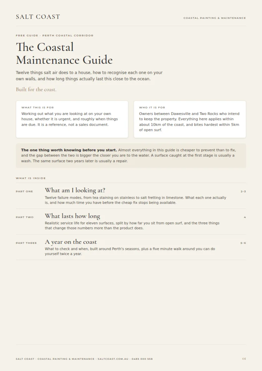
The Coastal Maintenance Guide
Six pages on what salt, sun and driven rain actually do to a coastal home, what to look for on your own walls, and roughly how long you have before each one turns into a repair.
We email the guide, then occasional coastal maintenance reminders, no more than a few times a year. Reply to any of them to stop. See our privacy policy.